Delemar Highway Ashley Ridge HS to Clay Field Tr
Project Description
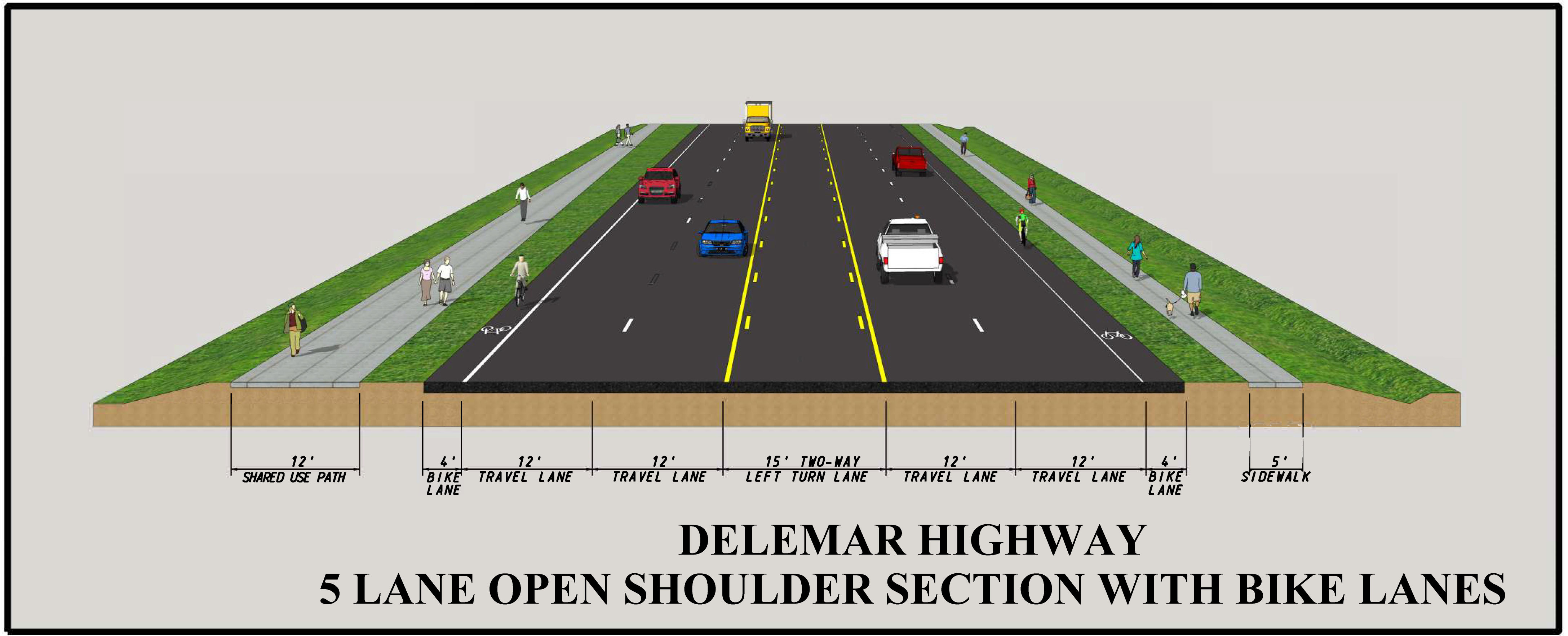
This project includes the widening of Delemar Highway between Ashley Ridge High School and Clay Field Trail to reduce traffic congestion, improve safety, and accommodate bicyclists and pedestrians.
The blue outline on the map indicates the general vicinity for the transportation project. The boundary is for informational purposes only and does NOT indicate property impacts.
Proposed Road Section
Dashboard
The embedded Power BI Dashboards can be viewed in full screen by clicking the arrow ![]() on the bottom right of the BI Dashboard. Press ESC to exit full screen and return to the Home page.
on the bottom right of the BI Dashboard. Press ESC to exit full screen and return to the Home page.